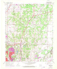
1956 Map of Spencer
USGS Topo · Published 1970About this map
The northern edge of Oklahoma City and the expanding town of Edmond meet in this mid-century portrait of Oklahoma County's suburban and industrial growth. The landscape is defined by the Deep Fork and North Canadian River valleys, where heavy infrastructure like the Turner Toll Road and the Expressway Junction carves through the rolling terrain. Cultural landmarks such as the Cowboy Hall of Fame and Oklahoma Christian College signal the area's development, while older agrarian roots are preserved in the numerous country schools like Sunnyside Sch and Oakdale Sch.
Find a feature on this map
77 named features on this map. Tap any name to fly to it.
Don’t see what you’re looking for? This feature index may not catch every label — zoom into the map to look around manually.
Map Details
Editions of this 1956 Spencer Map
3 editions found
Other maps of this area

1892 · Moore
USGS Topo · 1:62,500

1892 · Edmond
USGS Topo · 1:62,500

1892 · Kingfisher
USGS Topo · 1:125,000

1893 · Oklahoma City
USGS Topo · 1:62,500

1895 · Kingfisher
USGS Topo · 1:125,000

1898 · Purcell
USGS Topo · 1:125,000

1904 · Chickasha
USGS Topo · 1:125,000

1934 · Crutcho Creek
USGS Topo · 1:24,000

1934 · Moore
USGS Topo · 1:62,500

1935 · Spencer
USGS Topo · 1:24,000