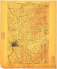
1901 Map of Spokane
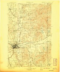
USGS Topo · Published 1911About this map
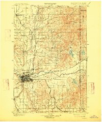
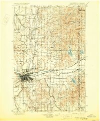
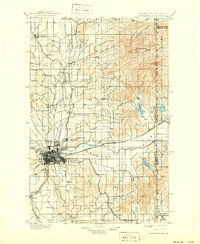
Spokane serves as the dominant rail and trade hub in this 1898 survey, where the Spokane River cuts westward through a valley flanked by broad elevated flats. The map illustrates a landscape transitioning from the open spaces of Fivemile Prairie and Peone Prairie to the industrial growth at Hillyard and East Spokane. Transportation is the defining characteristic of the era, with the Great Northern R. R., Northern Pacific R. R., and the Oregon R. R. & Navigation Co. converging on the city. To the north and east, the terrain rises toward Mt. Carlton and the Washington Idaho Boundary Line, while smaller settlements like Deer Park and Chattaroy follow the drainage of the Little Spokane River. The southern reaches are defined by the timbered hills near Mica and the northern edge of the Coeur d'Alene Ind. Res.
Find a feature on this map
66 named features on this map. Tap any name to fly to it.
Don’t see what you’re looking for? This feature index may not catch every label — zoom into the map to look around manually.
Map Details
Editions of this 1901 Spokane Map
6 editions found

Historical Maps of Spokane Through Time
5 maps found