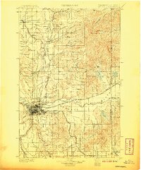
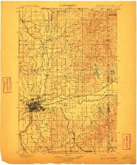
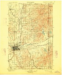
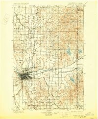
1901 Map of Spokane
USGS Topo · Published 1907About this map
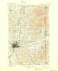
Spokane serves as the industrial and transportation nexus in this turn-of-the-century landscape, where a sophisticated rail network converges. The Great Northern R.R., Northern Pacific R.R., and Oregon R.R. & Navigation Co. define the urban growth patterns of East Spokane and Hillyard, while the broad Spokane Valley extends eastward toward the Idaho border. The map documents a geography of distinct elevated flats, such as Fivemile Prairie and Peone Prairie, which provide a stark contrast to the dense river-bottom development.
Find a feature on this map
65 named features on this map. Tap any name to fly to it.
Don’t see what you’re looking for? This feature index may not catch every label — zoom into the map to look around manually.
Map Details
Editions of this 1901 Spokane Map
6 editions found
Other maps of this area

1901 · Sandpoint
USGS Topo · 1:125,000

1901 · Spokane
USGS Topo · 1:125,000

1903 · Oakesdale
USGS Topo · 1:125,000

1903 · Rathdrum
USGS Topo · 1:125,000

1905 · Oakesdale
USGS Topo · 1:125,000

1911 · Priest Lake
USGS Topo · 1:250,000

1911 · Sandpoint
USGS Topo · 1:125,000

1913 · Priest Lake
USGS Topo · 1:250,000

1927 · Chewelah
USGS Topo · 1:125,000

1930 · Chewelah
USGS Topo · 1:125,000