1901 Map of Spokane
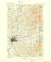
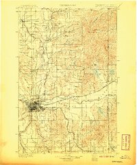
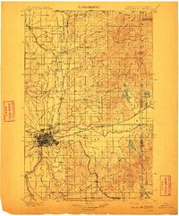
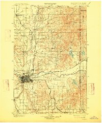
USGS Topo · Published 1939About this map
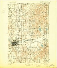
The Spokane rail hub and the broad Spokane Valley are the focal points of this late 19th-century survey, conducted as the region transitioned into a major inland empire. The city's growing footprint is flanked by Ft. Wright and burgeoning communities like Lidgerwood and Hillyard, while the surrounding landscape is defined by vast flatlands including Fivemile Prairie and Peone Prairie. The era’s industrial strength is visible through the converging lines of the Great Northern Railway and the Northern Pacific Railway.
Find a feature on this map
67 named features on this map. Tap any name to fly to it.
Don’t see what you’re looking for? This feature index may not catch every label — zoom into the map to look around manually.
Map Details
Editions of this 1901 Spokane Map
6 editions found
Other maps of this area

1901 · Sandpoint
USGS Topo · 1:125,000

1901 · Spokane
USGS Topo · 1:125,000

1903 · Oakesdale
USGS Topo · 1:125,000

1903 · Rathdrum
USGS Topo · 1:125,000

1905 · Oakesdale
USGS Topo · 1:125,000

1911 · Priest Lake
USGS Topo · 1:250,000

1911 · Sandpoint
USGS Topo · 1:125,000

1913 · Priest Lake
USGS Topo · 1:250,000

1927 · Chewelah
USGS Topo · 1:125,000

1930 · Chewelah
USGS Topo · 1:125,000