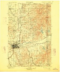
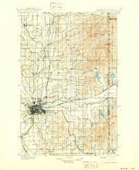
1901 Map of Spokane
USGS Topo · Published 1915About this map
The growing city of Spokane serves as the hub of this Inland Empire landscape, captured just before the turn of the century and updated through the 1910s. The map illustrates a period of intense rail expansion, with the Great Northern Ry, Northern Pacific Ry, and Spokane and Inland Ry converging on the urban core and extending through the Spokane Valley. Beyond the city grid, the terrain transitions into the high agricultural lands of Peone Prairie and Fivemile Prairie, while the northeast corner is dominated by the prominence of Mt Spokane and Mt Carson. Local history is preserved in the detailed naming of early settlements such as Hillyard, Deer Park, and Spokane Bridge, alongside numerous rural post offices and small communities that helped define the borderlands between Washington and Idaho.
Find a feature on this map
61 named features on this map. Tap any name to fly to it.
Don’t see what you’re looking for? This feature index may not catch every label — zoom into the map to look around manually.
Map Details
Editions of this 1901 Spokane Map
6 editions found
Other maps of this area

1901 · Sandpoint
USGS Topo · 1:125,000

1901 · Spokane
USGS Topo · 1:125,000

1903 · Oakesdale
USGS Topo · 1:125,000

1903 · Rathdrum
USGS Topo · 1:125,000

1905 · Oakesdale
USGS Topo · 1:125,000

1911 · Priest Lake
USGS Topo · 1:250,000

1911 · Sandpoint
USGS Topo · 1:125,000

1913 · Priest Lake
USGS Topo · 1:250,000

1927 · Chewelah
USGS Topo · 1:125,000

1930 · Chewelah
USGS Topo · 1:125,000