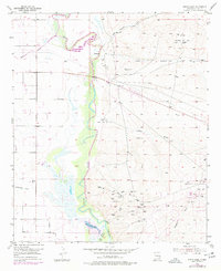
1955 Map of Spring Lake
USGS Topo · Published 1977About this map
The Pecos River carves a winding path through this landscape, flanked by a series of irrigation and drainage features that define the mid-century agricultural and industrial character of Eddy County. The presence of the Kaiser Channel and the Pecos River (Old Channel) indicates a highly managed riparian system, while Spring Lake and Brainard Lake offer rare permanent water in this arid environment.
Find a feature on this map
18 named features on this map. Tap any name to fly to it.
Don’t see what you’re looking for? This feature index may not catch every label — zoom into the map to look around manually.
Map Details
Editions of this 1955 Spring Lake Map
Other maps of this area

1943 · Oil City
USGS Topo · 1:62,500

1951 · Diamond Mound
USGS Topo · 1:24,000

1953 · Espuela
USGS Topo · 1:24,000

1954 · Carlsbad
USGS Topo · 1:250,000

1955 · Artesia
USGS Topo · 1:24,000

1955 · Artesia NE
USGS Topo · 1:24,000

1955 · Spring Lake
USGS Topo · 1:24,000

1955 · Dayton
USGS Topo · 1:24,000

1955 · Lake Mc Millan North
USGS Topo · 1:24,000

1955 · Red Lake
USGS Topo · 1:24,000