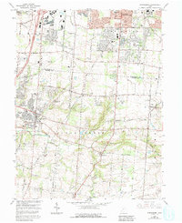
1965 Map of Springboro
USGS Topo · Published 1992About this map
Centerville and Springboro anchor this mid-1960s survey of the Miami Valley at the border of Montgomery and Warren counties. The landscape is characterized by a mix of emerging suburban developments and established agricultural tracts, particularly around Five Points and Kerricksville. Small rural nodes like Ridgeville and Pekin provide focal points for local history, with the latter featuring the notable Old Pekin Railroad Grade.
Find a feature on this map
66 named features on this map. Tap any name to fly to it.
Don’t see what you’re looking for? This feature index may not catch every label — zoom into the map to look around manually.
Map Details
Editions of this 1965 Springboro Map
4 editions found
Other maps of this area

1904 · Mason
USGS Topo · 1:62,500

1906 · Mason
USGS Topo · 1:62,500

1908 · Miamisburg
USGS Topo · 1:62,500

1913 · Waynesville
USGS Topo · 1:62,500

1914 · Morrow
USGS Topo · 1:62,500

1915 · Waynesville
USGS Topo · 1:62,500

1916 · Morrow
USGS Topo · 1:62,500

1951 · Franklin
USGS Topo · 1:24,000

1953 · Cincinnati
USGS Topo · 1:250,000

1955 · Monroe
USGS Topo · 1:24,000