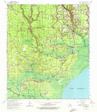
1963 Map of Springfield
USGS Topo · Published 1972About this map
The Tickfaw River and Amite River systems converge in this 1960s study of the Louisiana lowlands, where several major waterways reach their head of navigation. The map documents a dense network of river-oriented settlements and family-named landmarks, from Springfield to the smaller fishing and timber communities of Killian and Clio. This era captures the landscape before modern suburbanization, showing a high concentration of community centers such as St Margarets Ch, Hungarian Ch, and Albany-Springfield High Sch.
Find a feature on this map
90 named features on this map. Tap any name to fly to it.
Don’t see what you’re looking for? This feature index may not catch every label — zoom into the map to look around manually.
Map Details
Editions of this 1963 Springfield Map
2 editions found
Other maps of this area

1892 · Mount Airy
USGS Topo · 1:62,500

1892 · Bonnet Carre
USGS Topo · 1:62,500

1892 · Donaldsonville
USGS Topo · 1:62,500

1934 · Denham Springs
USGS Topo · 1:62,500

1934 · Springfield
USGS Topo · 1:62,500

1935 · Ponchatoula
USGS Topo · 1:62,500

1936 · Ruddock
USGS Topo · 1:31,680

1936 · Bonnet Carre
USGS Topo · 1:62,500

1939 · Ponchatoula
USGS Topo · 1:62,500

1939 · Springfield
USGS Topo · 1:62,500