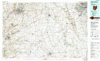
1986 Map of Springfield
USGS Topo · Published 1990About this map
The Mad River and its numerous tributaries, including Buck Creek and Massies Creek, define the agricultural and institutional character of this Central Ohio corridor in the late 1980s. Anchoring the west, Springfield is mapped alongside the significant waters of the Clarence J Brown Reservoir and Buck Creek State Park. The region is a hub for higher education, clearly marking the campuses of Wittenberg University, Cedarville College, and Wilberforce University.
Find a feature on this map
276 named features on this map. Tap any name to fly to it.
Don’t see what you’re looking for? This feature index may not catch every label — zoom into the map to look around manually.
Map Details
Editions of this 1986 Springfield Map
2 editions found
Other maps of this area

1901 · Dublin
USGS Topo · 1:62,500

1902 · Westerville
USGS Topo · 1:62,500

1903 · Dublin
USGS Topo · 1:62,500

1904 · Westerville
USGS Topo · 1:62,500

1904 · Springfield
USGS Topo · 1:62,500

1904 · Dayton
USGS Topo · 1:62,500

1906 · Dayton
USGS Topo · 1:62,500

1906 · Springfield
USGS Topo · 1:62,500

1906 · Mt Sterling
USGS Topo · 1:62,500

1906 · Chillicothe
USGS Topo · 1:62,500