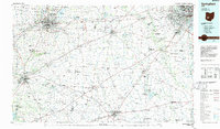
1986 Map of Springfield
USGS Topo · Published 1986About this map
Springfield and the surrounding agricultural counties of Clark, Madison, and Greene are documented here during the mid-1980s, reflecting a landscape defined by traditional rail corridors and the growth of modern interstate travel. The industrial and residential reach of Columbus and Grove City extends into the eastern portion of the map, while established towns like Xenia and Washington Court House anchor the southern reaches. This era shows the mature development of regional water management and recreation, highlighted by the Clarence J Brown Reservoir and Deer Creek State Park.
Find a feature on this map
262 named features on this map. Tap any name to fly to it.
Don’t see what you’re looking for? This feature index may not catch every label — zoom into the map to look around manually.
Map Details
Editions of this 1986 Springfield Map
2 editions found
Other maps of this area

1901 · Dublin
USGS Topo · 1:62,500

1902 · Westerville
USGS Topo · 1:62,500

1903 · Dublin
USGS Topo · 1:62,500

1904 · Westerville
USGS Topo · 1:62,500

1904 · Springfield
USGS Topo · 1:62,500

1904 · Dayton
USGS Topo · 1:62,500

1906 · Dayton
USGS Topo · 1:62,500

1906 · Springfield
USGS Topo · 1:62,500

1906 · Mt Sterling
USGS Topo · 1:62,500

1906 · Chillicothe
USGS Topo · 1:62,500