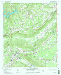
1958 Map of Springville
USGS Topo · Published 1978About this map
Springville serves as the primary hub in this late 1950s landscape, positioned where the Southern Railway follows the valley floor between significant ridge lines. The terrain is defined by the massive presence of Blount Mountain and Jones Mountain, which dictate the paths of drainage systems like Big Canoe Creek and its various tributaries. This 1958 survey captures a community deeply rooted in its geography, with numerous country churches such as Oak Grove Ch and New Hope Ch scattered across the valley and ridge slopes.
Find a feature on this map
38 named features on this map. Tap any name to fly to it.
Don’t see what you’re looking for? This feature index may not catch every label — zoom into the map to look around manually.
Map Details
Editions of this 1958 Springville Map
4 editions found
Other maps of this area

1889 · Springville
USGS Topo · 1:125,000

1889 · Birmingham
USGS Topo · 1:125,000

1892 · Birmingham
USGS Topo · 1:125,000

1892 · Springville
USGS Topo · 1:125,000

1895 · Birmingham
USGS Topo · 1:125,000

1905 · Leeds
USGS Topo · 1:62,500

1907 · Birmingham
USGS Topo · 1:125,000

1907 · Leeds
USGS Topo · 1:62,500

1953 · Birmingham
USGS Topo · 1:250,000

1956 · Birmingham
USGS Topo · 1:250,000