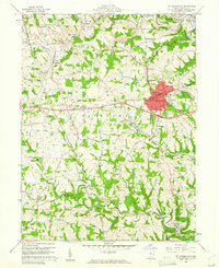
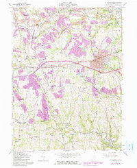
1960 Map of St. Clairsville
USGS Topo · Published 1961About this map
St. Clairsville serves as the focal point for this Belmont County landscape, sitting at the junction of the historic National Road and the Baltimore and Ohio railroad. The 1960s terrain is marked by a blend of civic infrastructure and coal-era industry, featuring the County Sanatorium and the County Experimental Farm alongside active Strip Mine operations and numerous mine dumps. The area's social and spiritual history is preserved in a dense network of landmarks, including the Union Cemetery, Friends Cem, and Richland Ch.
Find a feature on this map
67 named features on this map. Tap any name to fly to it.
Don’t see what you’re looking for? This feature index may not catch every label — zoom into the map to look around manually.
Map Details
Editions of this 1960 St. Clairsville Map
5 editions found
Other maps of this area

1903 · Flushing
USGS Topo · 1:62,500

1905 · Clarington
USGS Topo · 1:62,500

1905 · St. Clairsville
USGS Topo · 1:62,500

1905 · Woodsfield
USGS Topo · 1:62,500

1905 · Flushing
USGS Topo · 1:62,500

1935 · Clarington
USGS Topo · 1:62,500

1940 · Clarington
USGS Topo · 1:62,500

1949 · Clarksburg
USGS Topo · 1:250,000

1951 · Canton
USGS Topo · 1:250,000

1953 · Canton
USGS Topo · 1:250,000