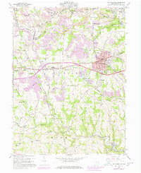
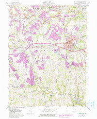
1960 Map of St. Clairsville
USGS Topo · Published 1978About this map
Belmont County's ridge-and-hollow terrain is shown here as it appeared following a mid-century period of industrial and municipal development. The county seat at St Clairsville is the primary hub, anchored by the Courthouse and the Fairgrounds, while the surrounding landscape is marked by public institutions like the County Sanatorium, the Infirmary, and the County Experimental Farm. This 1960s-era geography reflects a reliance on both traditional agriculture and the coal industry, evidenced by numerous mines and rail spurs.
Find a feature on this map
92 named features on this map. Tap any name to fly to it.
Don’t see what you’re looking for? This feature index may not catch every label — zoom into the map to look around manually.
Map Details
Editions of this 1960 St. Clairsville Map
5 editions found
Other maps of this area

1903 · Flushing
USGS Topo · 1:62,500

1905 · Clarington
USGS Topo · 1:62,500

1905 · St. Clairsville
USGS Topo · 1:62,500

1905 · Woodsfield
USGS Topo · 1:62,500

1905 · Flushing
USGS Topo · 1:62,500

1935 · Clarington
USGS Topo · 1:62,500

1940 · Clarington
USGS Topo · 1:62,500

1949 · Clarksburg
USGS Topo · 1:250,000

1951 · Canton
USGS Topo · 1:250,000

1953 · Canton
USGS Topo · 1:250,000