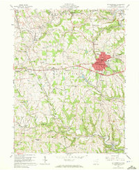
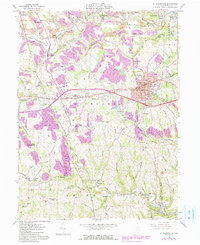
1960 Map of St. Clairsville
USGS Topo · Published 1972About this map
St Clairsville serves as the focal point of this Belmont County survey, where the historic National Road and U.S. Highway 40 intersect at the county seat's courthouse. The landscape is a complex mix of civic infrastructure and coal-country topography, featuring the County Home, County Sanatorium, and County Experimental Farm just west of the main settlement. The industrial character of the era is evident through the numerous strip mines and mine dumps that dot the hillsides, particularly around Bannock and Fairpoint. Transportation networks are densely packed, with the B & O RR and the New York Central RR carving paths through valleys like those of Wheeling Creek and McMahon Creek. Genealogists will find significant value in the documentation of several burial grounds, including the Union Cemetery, Butcher Cem, and the Wesley Chapel Cemetery near Chapel Hill.
Find a feature on this map
73 named features on this map. Tap any name to fly to it.
Don’t see what you’re looking for? This feature index may not catch every label — zoom into the map to look around manually.
Map Details
Editions of this 1960 St. Clairsville Map
5 editions found
Other maps of this area

1903 · Flushing
USGS Topo · 1:62,500

1905 · Clarington
USGS Topo · 1:62,500

1905 · St. Clairsville
USGS Topo · 1:62,500

1905 · Woodsfield
USGS Topo · 1:62,500

1905 · Flushing
USGS Topo · 1:62,500

1935 · Clarington
USGS Topo · 1:62,500

1940 · Clarington
USGS Topo · 1:62,500

1949 · Clarksburg
USGS Topo · 1:250,000

1951 · Canton
USGS Topo · 1:250,000

1953 · Canton
USGS Topo · 1:250,000