
1948 Map of St. Lucie Inlet
USGS Topo · Published 1958About this map
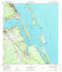
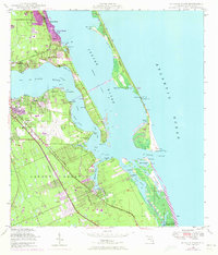
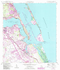
The confluence of the St Lucie River and the Indian River defines this coastal landscape as it appeared in the late 1940s. The bustling hub of Stuart is centered in the west, while the massive airfield at Witham Field dominates the central peninsula. Navigation is a central theme of the era, from the deep-water Intracoastal Waterway to the dangerous waters around the St Lucie Inlet, where features like Hole in the Wall and Hell Gate hint at the challenges for local mariners.
Find a feature on this map
52 named features on this map. Tap any name to fly to it.
Don’t see what you’re looking for? This feature index may not catch every label — zoom into the map to look around manually.
Map Details
Editions of this 1948 St. Lucie Inlet Map
4 editions found
Other maps of this area

1948 · Palm City
USGS Topo · 1:24,000

1948 · Ankona
USGS Topo · 1:24,000

1948 · Gomez
USGS Topo · 1:24,000

1948 · Hobe Sound
USGS Topo · 1:24,000

1948 · Eden
USGS Topo · 1:24,000

1949 · Gomez
USGS Topo · 1:24,000

1949 · Hobe Sound
USGS Topo · 1:24,000

1950 · St. Lucie Inlet
USGS Topo · 1:24,000

1950 · Ankona
USGS Topo · 1:24,000

1950 · Palm City
USGS Topo · 1:24,000