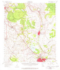
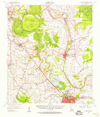
1957 Map of St. Martinville
USGS Topo · Published 1965About this map
Bayou Teche winds through the heart of Acadiana in this mid-century survey, anchoring the historic corridor between St Martinville and New Iberia. The landscape reflects a transition from traditional river-bound commerce to a more mechanized era, featuring both the sprawling US Naval Auxiliary Air Station and several significant agricultural estates such as Romero Plantation and Hopeland Plantation. The importance of water management to the local economy is evident in the network of man-made cuts like the Evangeline Canal and Ruth Canal. To the north and west, the map captures the burgeoning fringes of Lafayette and smaller railroad-aligned communities like Broussard and Cade. Cultural and community hubs are well-documented, from the Longfellow-Evangeline State Park to local landmarks like Mt Olive Ch and Livingston Sch.
Find a feature on this map
60 named features on this map. Tap any name to fly to it.
Don’t see what you’re looking for? This feature index may not catch every label — zoom into the map to look around manually.
Map Details
Editions of this 1957 St. Martinville Map
2 editions found
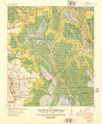
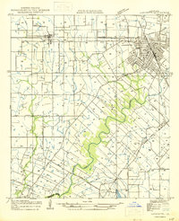
Other maps of this area

1932 · Abbeville NE
USGS Topo · 1:31,680

1935 · Osca Bayou
USGS Topo · 1:62,500

1937 · Jeanerette
USGS Topo · 1:62,500

1937 · Derouen
USGS Topo · 1:62,500

1939 · St. Martinsville
USGS Topo · 1:62,500

1940 · Arnaudville
USGS Topo · 1:62,500
1941 · Loreauville
USGS Topo · 1:62,500

1945 · New Orleans
USGS Topo · 1:250,000

1946 · Milton
USGS Topo · 1:31,680
1946 · Lafayette
USGS Topo · 1:31,680