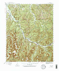
1943 Map of St. Paul
USGS Topo · Published 1973About this map
St Paul and the upper reaches of the White River anchor this 1943 survey, which documents the rural landscape of Madison and Washington counties before mid-century modernization. The terrain is defined by a dense network of hollows and ridges, including Ridley Hollow and Potato Knob, where small communities like Delaney, Combs, and Patrick developed along the river’s path. The map reveals an exceptionally high density of local institutions, with numerous rural schools such as Accident Sch and Plain View Sch serving isolated families.
Find a feature on this map
101 named features on this map. Tap any name to fly to it.
Don’t see what you’re looking for? This feature index may not catch every label — zoom into the map to look around manually.
Map Details
Editions of this 1943 St. Paul Map
5 editions found

Other maps of this area

1879 · Cravens
USGS Topo · 1:62,500

1887 · Watalula
USGS Topo · 1:62,500

1898 · Winslow #4
USGS Topo · 1:62,500

1898 · Winslow
USGS Topo · 1:125,000

1899 · Fayetteville
USGS Topo · 1:125,000

1900 · Eureka Springs
USGS Topo · 1:125,000

1901 · Winslow
USGS Topo · 1:125,000

1901 · Eureka Springs
USGS Topo · 1:125,000

1901 · Fayetteville
USGS Topo · 1:125,000

1904 · Fayetteville
USGS Topo · 1:125,000