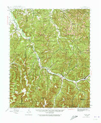
1943 Map of St. Paul
USGS Topo · Published 1973About this map
White River headwaters dominate the landscape of the Boston Mountains in this mid-century survey of Madison and Washington Counties. The settlement at St Paul serves as a local hub along State Route 16, while smaller communities like Combs, Delaney, and Brashears Junction mark the transition from river bottom to high ridges. The map reveals an intricate network of local history through its many remote burial sites, such as Mt Liberty Cem, Asher Cem, and Burrell Cem. These cemeteries, often paired with nearby landmarks like Mountain View Sch or Shumate Ch, provide critical waypoints for genealogists tracking family roots in the rugged hills of the Ozark National Forest. Elevations climb steeply toward Pinnacle, Potato Knob, and High Rock Mtn, while the Middle Fork White River carves through the western reaches past Durham and Crosses.
Find a feature on this map
126 named features on this map. Tap any name to fly to it.
Don’t see what you’re looking for? This feature index may not catch every label — zoom into the map to look around manually.
Map Details
Editions of this 1943 St. Paul Map
5 editions found

Other maps of this area

1879 · Cravens
USGS Topo · 1:62,500

1887 · Watalula
USGS Topo · 1:62,500

1898 · Winslow #4
USGS Topo · 1:62,500

1898 · Winslow
USGS Topo · 1:125,000

1899 · Fayetteville
USGS Topo · 1:125,000

1900 · Eureka Springs
USGS Topo · 1:125,000

1901 · Winslow
USGS Topo · 1:125,000

1901 · Eureka Springs
USGS Topo · 1:125,000

1901 · Fayetteville
USGS Topo · 1:125,000

1904 · Fayetteville
USGS Topo · 1:125,000