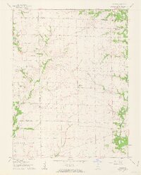
1962 Map of St. Rose
USGS Topo · Published 1963About this map
The agricultural landscape of eastern Illinois is defined here by the confluence of several townships, including Saline, Burg, Helvetia, and St Rose. Surveyed in the early 1960s, the map reveals a region transitioning from isolated 19th-century hamlets toward a more modern rural grid. The settlement of St Rose serves as a central hub, while the smaller community of Sebastopol stands to the northwest, highlighting the importance of these local crossroads before the expansion of regional highways.
Find a feature on this map
16 named features on this map. Tap any name to fly to it.
Don’t see what you’re looking for? This feature index may not catch every label — zoom into the map to look around manually.
Map Details
Editions of this 1962 St. Rose Map
2 editions found
Other maps of this area

1906 · Breese
USGS Topo · 1:62,500

1907 · Breese
USGS Topo · 1:62,500

1910 · Carlyle
USGS Topo · 1:62,500

1932 · Greenville
USGS Topo · 1:62,500

1937 · New Douglas
USGS Topo · 1:48,000

1939 · Greenville
USGS Topo · 1:62,500

1943 · Greenville
USGS Topo · 1:62,500

1944 · New Douglas
USGS Topo · 1:62,500

1948 · Carlyle
USGS Topo · 1:62,500
1957 · Highland
USGS Topo · 1:24,000