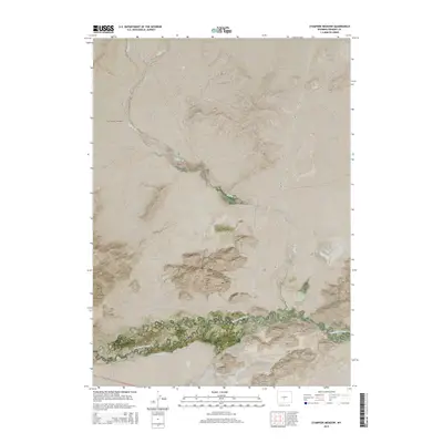
2015 Map of Stampede Meadow
USGS Topo · Published 2015About this map
The Sweetwater River carves through this high-altitude Wyoming landscape, where the southern reaches of the Granite Mountains meet the sweeping flats of Stampede Meadow. This map captures a remote section of Fremont County defined by its water-management history and long-standing ranching routes. The presence of the Emigrant Ditch running parallel to the river reflects early 20th-century irrigation efforts vital to survival in this arid environment. Significant watercourses like Buffalo Cr and Tin Cup Cr feed into the river system, while the road network indicates the area's utility. Ore Rd and Black Rock Rd intersect the terrain, likely serving local mining or ranching interests, while Highway 287 provides the primary modern connection through the region. The map offers a clear view of the Public Land Survey System (PLSS) grid, documenting the townships and ranges that organize this portion of the American West.
Find a feature on this map
15 named features on this map. Tap any name to fly to it.
Don’t see what you’re looking for? This feature index may not catch every label — zoom into the map to look around manually.
Map Details
Editions of this 2015 Stampede Meadow Map
This is the sole edition of this map. No revisions or reprints were ever made.
Other maps of this area

1951 · Crooks Creek NE
USGS Topo · 1:24,000

1951 · Stampede Meadow
USGS Topo · 1:24,000

1951 · Black Rock Gap
USGS Topo · 1:24,000

1951 · Graham Ranch
USGS Topo · 1:24,000

1951 · Split Rock NW
USGS Topo · 1:24,000

1951 · Crooks Mountain
USGS Topo · 1:24,000

1952 · Tin Cup Mountain
USGS Topo · 1:24,000

1952 · Muskrat Basin
USGS Topo · 1:24,000

1952 · Coyote Springs
USGS Topo · 1:24,000

1955 · Casper
USGS Topo · 1:250,000