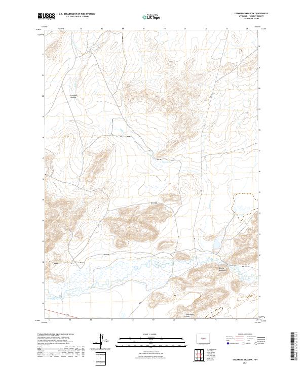
2021 Map of Stampede Meadow
USGS Topo · Published 2021About this map
Sweetwater River meanders across the southern portion of this high-desert landscape in Fremont County, marking a vital water source in an arid region. The terrain is defined by the high elevations of the Granite Mountains and the prominent outcrops of the Sweetwater Rocks. To the north, the topography softens into the wide expanse of Stampede Meadow and the nearby Stampede Bog, which are fed by the intermittent flows of Buffalo Creek and Tin Cup Cr. Evidence of early water management and cattle ranching history is visible in the presence of the Emigrant Ditch, which cuts across the flats south of the river. The lone named thoroughfare, Ore Rd, suggests a legacy of resource extraction or transport through this isolated stretch of the Wyoming interior.
Find a feature on this map
16 named features on this map. Tap any name to fly to it.
Don’t see what you’re looking for? This feature index may not catch every label — zoom into the map to look around manually.
Map Details
Editions of this 2021 Stampede Meadow Map
This is the sole edition of this map. No revisions or reprints were ever made.
Other maps of this area

1951 · Crooks Creek NE
USGS Topo · 1:24,000

1951 · Stampede Meadow
USGS Topo · 1:24,000

1951 · Black Rock Gap
USGS Topo · 1:24,000

1951 · Graham Ranch
USGS Topo · 1:24,000

1951 · Split Rock NW
USGS Topo · 1:24,000

1951 · Crooks Mountain
USGS Topo · 1:24,000

1952 · Tin Cup Mountain
USGS Topo · 1:24,000

1952 · Muskrat Basin
USGS Topo · 1:24,000

1952 · Coyote Springs
USGS Topo · 1:24,000

1955 · Casper
USGS Topo · 1:250,000