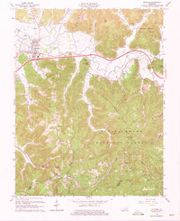
1966 Map of Stanton
USGS Topo · Published 1975About this map
Red River meanders through this portion of the Daniel Boone National Forest, serving as a focal point for the settlement patterns in the mid-1960s. The town of Stanton is shown with its developing infrastructure, including the Stanton Airport and a Filtration Plant, while the Mountain Parkway cuts a modern path across the traditional landscape. To the south, the industrial history of the region is evident in the Oil Field scattered with numerous Oil Wells and the historic Estill Furnace Ruins near Furnace.
Find a feature on this map
61 named features on this map. Tap any name to fly to it.
Don’t see what you’re looking for? This feature index may not catch every label — zoom into the map to look around manually.
Map Details
Editions of this 1966 Stanton Map
Other maps of this area

1892 · Beattyville
USGS Topo · 1:125,000

1950 · Levee
USGS Topo · 1:24,000

1952 · Clay City
USGS Topo · 1:24,000

1952 · Frenchburg
USGS Topo · 1:24,000

1952 · Stanton
USGS Topo · 1:24,000

1952 · Means
USGS Topo · 1:24,000

1952 · Levee
USGS Topo · 1:24,000

1952 · Slade
USGS Topo · 1:24,000

1952 · Cobhill
USGS Topo · 1:24,000

1952 · Irvine
USGS Topo · 1:24,000