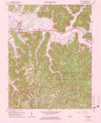
1966 Map of Stanton
USGS Topo · Published 1983About this map
The Red River winds through this mid-1960s landscape, serving as the northern boundary for the high ridges of the Daniel Boone National Forest. Centered on the community of Stanton, the map documents a period of infrastructure growth with the arrival of the Mountain Parkway and the Stanton Interchange, cutting a modern path across the traditional valley settlements. South of the river, the terrain rises sharply toward Chestnut Ridge and Kaincaid Mtn, where the industrial history of the region is preserved at the Estil Furnace Ruins and the scattered Oil Wells of the southern hills. Local life is anchored by numerous hollow-side institutions, including Morris Creek Ch, Hatcher Creek Ch, and the Bowen Sch. The presence of the High Rock Lookout Tower and Stanton Airport illustrates the mix of forest management and early aviation infrastructure that defined this part of Powell County.
Find a feature on this map
53 named features on this map. Tap any name to fly to it.
Don’t see what you’re looking for? This feature index may not catch every label — zoom into the map to look around manually.
Map Details
Editions of this 1966 Stanton Map
Other maps of this area

1892 · Beattyville
USGS Topo · 1:125,000

1950 · Levee
USGS Topo · 1:24,000

1952 · Clay City
USGS Topo · 1:24,000

1952 · Frenchburg
USGS Topo · 1:24,000

1952 · Stanton
USGS Topo · 1:24,000

1952 · Means
USGS Topo · 1:24,000

1952 · Levee
USGS Topo · 1:24,000

1952 · Slade
USGS Topo · 1:24,000

1952 · Cobhill
USGS Topo · 1:24,000

1952 · Irvine
USGS Topo · 1:24,000