
1960 Map of Stephen Creek
USGS Topo · Published 1962About this map
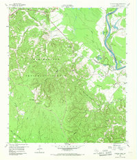
Sam Houston National Forest dominates the terrain of this 1960 survey, where dense piney woods meet the bottomlands of the Trinity River. The settlement of Pointblank sits at a critical junction of routes 190 and 156, serving as a gateway to the river crossing near the San Jacinto and Polk County line. The map reveals a landscape defined by small water bodies and sloughs, including Stephen Prairie Lake, Ben Shot Lake, and Floyd Hardin Lake, which flank the river's winding course. Cultural markers such as the Paul Horton Memorial Ch and Liberty Hill Cem provide essential anchor points for genealogists tracing families in the Stephens Creek area. High-ground landmarks like Snow Hill and the Willow Springs Lookout offer a sense of the elevation changes that characterize this region before it reaches the wide river flats.
Find a feature on this map
36 named features on this map. Tap any name to fly to it.
Don’t see what you’re looking for? This feature index may not catch every label — zoom into the map to look around manually.
Map Details
Editions of this 1960 Stephen Creek Map
Other maps of this area

1954 · Beaumont
USGS Topo · 1:250,000

1957 · Beaumont
USGS Topo · 1:250,000

1960 · Blanchard
USGS Topo · 1:24,000

1960 · Maynard
USGS Topo · 1:24,000

1960 · Carlisle
USGS Topo · 1:24,000

1960 · Camilla
USGS Topo · 1:24,000

1960 · Coldspring
USGS Topo · 1:24,000

1961 · Staley
USGS Topo · 1:24,000

1961 · Onalaska
USGS Topo · 1:24,000

1961 · Oakhurst
USGS Topo · 1:24,000