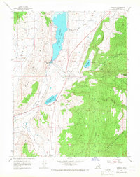
1966 Map of Sterling
USGS Topo · Published 1968About this map
The Denver and Rio Grande Western railroad corridor anchors this mid-1960s view of the Sanpete Valley, tracking past the town of Sterling and the northern edge of Mayfield. Water management is the defining human footprint here, visible through the large Gunnison Reservoir and the Ninemile Reservoir, which are fed by a complex network including the Highland Canal and Larson Ditch.
Find a feature on this map
38 named features on this map. Tap any name to fly to it.
Don’t see what you’re looking for? This feature index may not catch every label — zoom into the map to look around manually.
Map Details
Editions of this 1966 Sterling Map
2 editions found
Other maps of this area

1885 · Manti
USGS Topo · 1:250,000

1895 · Manti
USGS Topo · 1:250,000

1956 · Price
USGS Topo · 1:250,000

1960 · Price
USGS Topo · 1:250,000

1962 · Price
USGS Topo · 1:250,000
1965 · Woods Lake
USGS Topo · 1:24,000

1965 · Hells Kitchen Canyon SE
USGS Topo · 1:24,000
1965 · Mayfield
USGS Topo · 1:24,000

1965 · Manti
USGS Topo · 1:24,000

1965 · Black Mountain
USGS Topo · 1:24,000