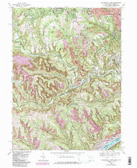
1968 Map of Steubenville West
USGS Topo · Published 1985About this map
Steubenville's western expansion and industrial footprint define the landscape of eastern Jefferson County in the late 1960s. The topography is heavily marked by the region's extractive history, showing extensive strip mining activity and numerous gas wells and oil wells scattered across the ridges. Large infrastructure such as the sewage disposal plant near Wintersville and the Cross Creek Airpark sit alongside historic community anchors like Union Cemetery and Mt Calvary Cemetery.
Find a feature on this map
65 named features on this map. Tap any name to fly to it.
Don’t see what you’re looking for? This feature index may not catch every label — zoom into the map to look around manually.
Map Details
Editions of this 1968 Steubenville West Map
4 editions found
Other maps of this area

1901 · Cadiz
USGS Topo · 1:62,500

1902 · Wheeling
USGS Topo · 1:62,500

1903 · Cadiz
USGS Topo · 1:62,500

1904 · Steubenville
USGS Topo · 1:62,500

1905 · St. Clairsville
USGS Topo · 1:62,500

1935 · Wheeling
USGS Topo · 1:62,500

1935 · Steubenville
USGS Topo · 1:62,500

1942 · Wheeling
USGS Topo · 1:62,500

1942 · Steubenville
USGS Topo · 1:62,500

1951 · Canton
USGS Topo · 1:250,000