1947 Map of Stevenson
USGS Topo · Published 1972About this map
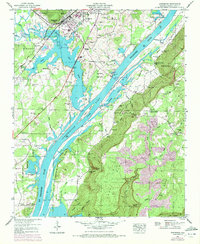
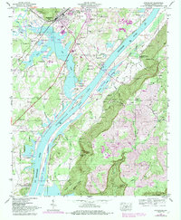
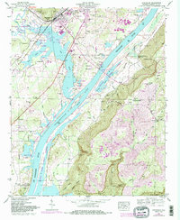
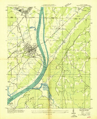
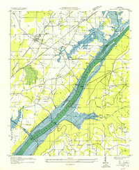
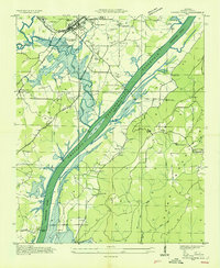
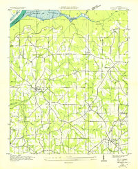
The town of Stevenson serves as a focal point in this valley landscape, situated where the Southern railroad lines intersect near the northern reaches of Guntersville Lake. The map captures the complex geography of the Tennessee River before and after the 1970 photorevision, showing the expansive waters surrounding the Baldridge Reservation. To the south, the terrain rises sharply into the plateaus of Sand Mountain, marked by deep incisions like Coon Gulf and Mason Hollow.
Find a feature on this map
64 named features on this map. Tap any name to fly to it.
Don’t see what you’re looking for? This feature index may not catch every label — zoom into the map to look around manually.
Map Details
Editions of this 1947 Stevenson Map
3 editions found
Other maps of this area

1886 · Stevenson
USGS Topo · 1:125,000

1892 · Stevenson
USGS Topo · 1:125,000

1895 · Stevenson
USGS Topo · 1:125,000
1936 · Ider
USGS Topo · 1:24,000
1936 · Bridgeport
USGS Topo · 1:24,000

1936 · Wannville
USGS Topo · 1:24,000

1936 · Flat Rock
USGS Topo · 1:24,000
1936 · Hollywood
USGS Topo · 1:24,000
1936 · Stevenson
USGS Topo · 1:24,000
1936 · Henagar
USGS Topo · 1:24,000