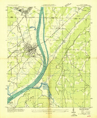
1947 Map of Stevenson
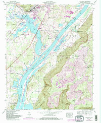
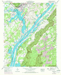
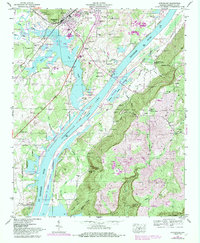
USGS Topo · Published 1984About this map
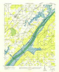
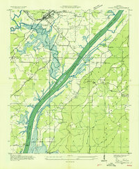
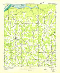
Guntersville Lake and the Tennessee River dominate this Jackson County landscape, where the Tennessee Valley Authority documented the region's mid-century character. The town of Stevenson serves as a local hub, defined by its position along the Southern and Seaboard railroads. This era captures the transition of the river valley, showing the relationship between established family sites like Wimberley Cem and Caperton Cem and the expanding water resources. To the southeast, Sand Mountain rises above the valley floor, home to settlements like Fabius and Old Fabius. The map preserves the location of traditional river crossings, including Caperton Ferry and Coffeys Ferry, alongside more modern infrastructure like the Captain John Snodgrass Bridge. Traces of industry are evident in the strip mines found on the high ground of the mountain, while the lowlands are dedicated to conservation in the Crow Creek Wildlife Management Area.
Find a feature on this map
73 named features on this map. Tap any name to fly to it.
Don’t see what you’re looking for? This feature index may not catch every label — zoom into the map to look around manually.
Map Details
Editions of this 1947 Stevenson Map
3 editions found
Other maps of this area

1886 · Stevenson
USGS Topo · 1:125,000

1892 · Stevenson
USGS Topo · 1:125,000

1895 · Stevenson
USGS Topo · 1:125,000
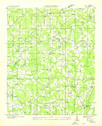
1936 · Ider
USGS Topo · 1:24,000
1936 · Bridgeport
USGS Topo · 1:24,000

1936 · Wannville
USGS Topo · 1:24,000

1936 · Flat Rock
USGS Topo · 1:24,000
1936 · Hollywood
USGS Topo · 1:24,000
1936 · Stevenson
USGS Topo · 1:24,000
1936 · Henagar
USGS Topo · 1:24,000