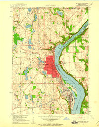
1951 Map of Stillwater
USGS Topo · Published 1959About this map
The St Croix River serves as the central artery for this mid-century portrait of the border between Minnesota and Wisconsin. Centered on Stillwater, the map reveals a dense network of early civic and social infrastructure, including Washington Sch, Lakeview Hospital, and several outlying country schools like Kilty Sch. The landscape is etched with the paths of major rail lines, including the Northern Pacific and the Chicago and North Western, which supported the industrial operations of the era.
Find a feature on this map
52 named features on this map. Tap any name to fly to it.
Don’t see what you’re looking for? This feature index may not catch every label — zoom into the map to look around manually.
Map Details
Editions of this 1951 Stillwater Map
4 editions found

Other maps of this area

1946 · Hudson
USGS Topo · 1:62,500

1946 · River Falls
USGS Topo · 1:62,500

1948 · New Richmond
USGS Topo · 1:62,500

1948 · Stillwater
USGS Topo · 1:62,500

1949 · New Richmond
USGS Topo · 1:62,500

1949 · River Falls
USGS Topo · 1:62,500

1949 · Hudson
USGS Topo · 1:62,500

1949 · Stillwater
USGS Topo · 1:62,500

1949 · Lake Elmo
USGS Topo · 1:24,000

1949 · Hudson
USGS Topo · 1:24,000