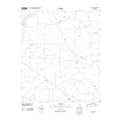
2010 Map of Stockard
USGS Topo · Published 2010About this map
Stockard and Pickens anchor this Henderson County landscape, representing small Texas settlements connected by a web of rural farm-to-market roads. The topography is defined by significant landmarks such as Big Rock Top and Melton Rock, while the drainage system of Clear Creek, Red Oak Branch, and Pottawatomie Creek shapes the local geography. This 2010 survey reveals a land primarily used for agriculture and small-scale water management, evidenced by Thomas Lake Dam and the curiously named Fly-In Lake. For local historians and genealogists, the map provides precise locations for several family and community burial grounds, including Moorehead Cemetery in the northwest, Cottonwood Cemetery near the center, and Sand Flat Cemetery to the east. The road network, comprising routes like FM 1861 and FM 2709, illustrates the modern connectivity of these rural communities while preserving the locations of these older landmarks.
Find a feature on this map
53 named features on this map. Tap any name to fly to it.
Don’t see what you’re looking for? This feature index may not catch every label — zoom into the map to look around manually.
Map Details
Editions of this 2010 Stockard Map
This is the sole edition of this map. No revisions or reprints were ever made.
Other maps of this area

1920 · Kemp
USGS Topo · 1:62,500

1948 · Martins Mill
USGS Topo · 1:62,500

1949 · Martins Mill
USGS Topo · 1:62,500

1949 · Athens
USGS Topo · 1:62,500

1950 · Athens
USGS Topo · 1:62,500

1954 · Dallas
USGS Topo · 1:250,000

1956 · Tyler
USGS Topo · 1:250,000

1957 · Kemp
USGS Topo · 1:62,500

1958 · Dallas
USGS Topo · 1:250,000

1960 · Mabank
USGS Topo · 1:24,000