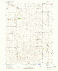
1964 Map of Stockland
USGS Topo · Published 1965About this map
The Chicago Milwaukee St Paul and Pacific railroad forms the primary corridor through this agricultural landscape along the Illinois-Indiana border during the early 1960s. The settlement of Stockland serves as a focal point in the north, while smaller locales like Hallock, Dawson Park, and Greer are distributed throughout the surrounding townships of Stockland, Prairie Green, and Parish Grove.
Find a feature on this map
19 named features on this map. Tap any name to fly to it.
Don’t see what you’re looking for? This feature index may not catch every label — zoom into the map to look around manually.
Map Details
Editions of this 1964 Stockland Map
This is the sole edition of this map. No revisions or reprints were ever made.
Other maps of this area

1933 · Hoopeston
USGS Topo · 1:48,000

1938 · Milford
USGS Topo · 1:48,000

1938 · Hoopeston
USGS Topo · 1:62,500

1944 · Milford
USGS Topo · 1:62,500

1953 · Danville
USGS Topo · 1:250,000

1955 · Danville
USGS Topo · 1:250,000

1956 · Danville
USGS Topo · 1:250,000

1961 · Tab
USGS Topo · 1:24,000

1962 · Boswell
USGS Topo · 1:24,000

1962 · Earl Park
USGS Topo · 1:24,000