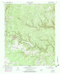
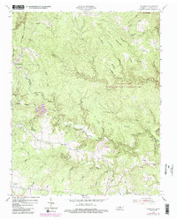
1954 Map of Stockton
USGS Topo · Published 1979About this map
The Cumberland Plateau landscape near Stockton is defined by the deep incisions of North White Oak Creek and its many tributaries, creating a complex network of ridges and hollows. During the mid-20th century, these narrow valley floors and upland benches supported a dispersed community of small homesteads and family burial grounds, including the Potter Cem and Terry Cem. The map reveals the local social geography through landmarks like the Stockton Sch and Alticrest Sch, while the presence of Coal Bank Hollow and Stone Coal Br points to the region's historic reliance on local mineral resources.
Find a feature on this map
72 named features on this map. Tap any name to fly to it.
Don’t see what you’re looking for? This feature index may not catch every label — zoom into the map to look around manually.
Map Details
Editions of this 1954 Stockton Map
6 editions found
Other maps of this area

1895 · Wartburg
USGS Topo · 1:125,000

1896 · Wartburg
USGS Topo · 1:125,000

1934 · Barthell
USGS Topo · 1:62,500

1934 · Pall Mall
USGS Topo · 1:62,500

1952 · Honey Creek
USGS Topo · 1:24,000

1952 · Rugby
USGS Topo · 1:24,000

1954 · Stockton
USGS Topo · 1:24,000

1954 · Burrville
USGS Topo · 1:24,000

1954 · Jamestown
USGS Topo · 1:24,000

1954 · Grimsley
USGS Topo · 1:24,000