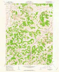
1961 Map of Stone Creek
USGS Topo · Published 1963About this map
Small agricultural and mining communities define this portion of Tuscarawas County during the early 1960s. The landscape is heavily marked by extractive industries, with numerous Strip Mines, Gas Wells, and Oil Wells peppered across the townships of Auburn, York, and Jefferson. The valley of Stone Creek serves as a primary transportation corridor, carrying the tracks of the Pennsylvania railroad through the namesake village and past the settlement of Blackband.
Find a feature on this map
32 named features on this map. Tap any name to fly to it.
Don’t see what you’re looking for? This feature index may not catch every label — zoom into the map to look around manually.
Map Details
Editions of this 1961 Stone Creek Map
3 editions found
Other maps of this area

1909 · Uhrichsville
USGS Topo · 1:62,500

1911 · Uhrichsville
USGS Topo · 1:62,500

1911 · Newcomerstown
USGS Topo · 1:62,500

1912 · Dover
USGS Topo · 1:62,500

1913 · Newcomerstown
USGS Topo · 1:62,500

1914 · Navarre
USGS Topo · 1:62,500

1943 · Newcomerstown
USGS Topo · 1:62,500

1944 · Navarre
USGS Topo · 1:62,500

1944 · Dover
USGS Topo · 1:62,500

1951 · Canton
USGS Topo · 1:250,000