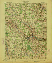
1913 Map of Stoneboro
USGS Topo · Published 1913About this map
Stoneboro and the adjacent Sandy Lake serve as the central landmarks of this 1913 survey, illustrating a Pennsylvania landscape defined by its complex waterway and rail connections. The Lake Shore and Michigan Southern Ry and the New Castle and Oil City Line intersect near the lake, highlighting the region's importance as a transportation hub. The surrounding townships are densely dotted with family-named schools and crossroads, such as Sheakleyville, Milledgeville, and New Lebanon.
Find a feature on this map
108 named features on this map. Tap any name to fly to it.
Don’t see what you’re looking for? This feature index may not catch every label — zoom into the map to look around manually.
Map Details
Editions of this 1913 Stoneboro Map
5 editions found

Other maps of this area

1905 · Neshannock
USGS Topo · 1:62,500

1906 · Linesville
USGS Topo · 1:62,500

1907 · Neshannock
USGS Topo · 1:62,500

1908 · Shenango
USGS Topo · 1:62,500

1908 · Linesville
USGS Topo · 1:62,500

1909 · Franklin
USGS Topo · 1:62,500

1910 · Hilliards
USGS Topo · 1:62,500

1911 · Franklin
USGS Topo · 1:62,500

1911 · Stoneboro
USGS Topo · 1:62,500

1912 · Hilliards
USGS Topo · 1:62,500