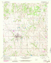
1967 Map of Stratford
USGS Topo · Published 1983About this map
Stratford and its surrounding rural landscapes are captured here at the intersection of Garvin, Pontotoc, and McClain Counties during the late 1960s. The town's organized grid is flanked by the Southeast Stratford Oil Field and scattered Oil Wells, highlighting the petroleum-driven economy of this central Oklahoma region. Evidence of changing transportation and land use is visible in the Old Railroad Grade cutting through the northwestern corner and the Sandpit to the south.
Find a feature on this map
25 named features on this map. Tap any name to fly to it.
Don’t see what you’re looking for? This feature index may not catch every label — zoom into the map to look around manually.
Map Details
Editions of this 1967 Stratford Map
3 editions found
Other maps of this area

1898 · Pauls Valley
USGS Topo · 1:125,000

1901 · Stonewall
USGS Topo · 1:125,000

1902 · Pauls Valley
USGS Topo · 1:125,000

1957 · Ardmore
USGS Topo · 1:250,000

1958 · Konawa
USGS Topo · 1:24,000

1963 · Ardmore
USGS Topo · 1:250,000

1964 · Byars
USGS Topo · 1:24,000

1965 · Pauls Valley NE
USGS Topo · 1:24,000
1965 · Wanette
USGS Topo · 1:24,000

1966 · Asher
USGS Topo · 1:24,000