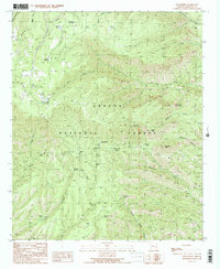
1991 Map of Strayhorse
USGS Topo · Published 1991About this map
Apache National Forest defines the high-country landscape of this Greenlee County region, where deep drainages like Eagle Creek and Bear Wallow Creek carve through the high elevations. The 1991 data reflects a working mountain landscape centered on forest management and livestock, evidenced by the Strayhorse Forest Service Station, Hagen Corral, and scattered infrastructure such as the Gravel Pit and Borrow Pit. Water is the primary driver of names and activity here, with numerous cienegas—high-altitude marshes—like KP Cienega and Cache Cienega providing rare moisture in the arid Arizona interior.
Find a feature on this map
45 named features on this map. Tap any name to fly to it.
Don’t see what you’re looking for? This feature index may not catch every label — zoom into the map to look around manually.
Map Details
Editions of this 1991 Strayhorse Map
2 editions found
Other maps of this area

1913 · Morenci
USGS Topo · 1:125,000

1915 · Morenci
USGS Topo · 1:125,000

1922 · Nutrioso
USGS Topo · 1:125,000

1954 · Clifton
USGS Topo · 1:250,000

1957 · Clifton
USGS Topo · 1:250,000

1958 · Clifton
USGS Topo · 1:250,000

1958 · Hannagan Meadow
USGS Topo · 1:62,500

1961 · Blue
USGS Topo · 1:62,500

1962 · Clifton
USGS Topo · 1:250,000

1967 · Robinson Mesa
USGS Topo · 1:24,000