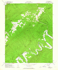
1962 Map of Strom
USGS Topo · Published 1963About this map
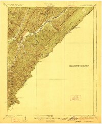
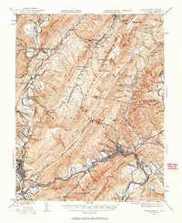
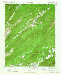
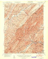
Roaring Run Furnace (Ruins) and the Grace Furnace (Ruins) stand as quiet indicators of the early industrial iron heritage of Botetourt and Alleghany counties. This 1960s survey documents the rugged landscape where the George Washington National Forest and Jefferson National Forest meet along the ridge of Rich Patch Mountain. The settlement pattern follows the serpentine bends of Craig Creek and Potts Creek, connecting small communities like Rich Patch, Strom, and Lignite. Local family history is preserved through several rural burial grounds, including Rose Hill Cem, Hooks Cem, and the King Memorial Cem. The map also details the transition from traditional water-powered sites like Hooks Mill to modern infrastructure, evidenced by a large Pipeline crossing the northern terrain and a network of unimproved roads and the Patterson Jeep Trail through the high gaps.
Find a feature on this map
65 named features on this map. Tap any name to fly to it.
Don’t see what you’re looking for? This feature index may not catch every label — zoom into the map to look around manually.
Map Details
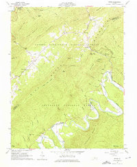
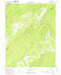
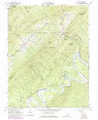
Editions of this 1962 Strom Map
4 editions found
Other maps of this area

1887 · Lewisburg
USGS Topo · 1:125,000

1891 · Lewisburg
USGS Topo · 1:125,000

1894 · Natural Bridge
USGS Topo · 1:125,000

1913 · Eagle Rock
USGS Topo · 1:48,000

1915 · Eagle Rock
USGS Topo · 1:62,500

1921 · Callaghan
USGS Topo · 1:48,000
1923 · Callaghan
USGS Topo · 1:62,500
1945 · Clifton Forge
USGS Topo · 1:62,500
1945 · New Castle
USGS Topo · 1:62,500
1946 · Callaghan
USGS Topo · 1:62,500