1962 Map of Strom
USGS Topo · Published 1976About this map
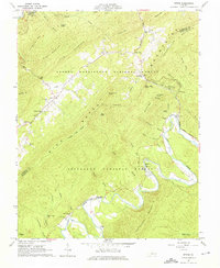
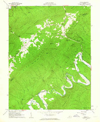
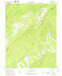
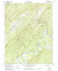
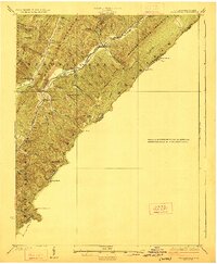
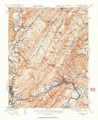
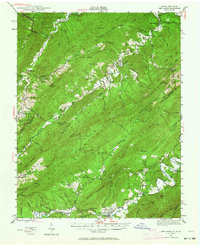
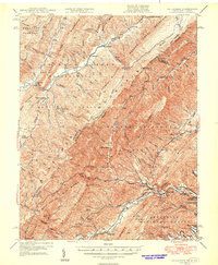
Rich Patch Mountain dominates this 1962 Virginia survey, defining a landscape shaped by iron-ore extraction and the winding course of Craig Creek. The presence of Roaring Run Furnace (Ruins) and the Grace Furnace (Ruins) further south points to the region's industrial heritage, while localized Strip Mines and a Quarry indicate active mineral resource use at the time of mapping. Small settlements and points of interest like Silent Dell, Hooks Mill, and Strom are scattered along the creek beds and gap crossings.
Find a feature on this map
67 named features on this map. Tap any name to fly to it.
Don’t see what you’re looking for? This feature index may not catch every label — zoom into the map to look around manually.
Map Details
Editions of this 1962 Strom Map
4 editions found
Other maps of this area

1887 · Lewisburg
USGS Topo · 1:125,000

1891 · Lewisburg
USGS Topo · 1:125,000

1894 · Natural Bridge
USGS Topo · 1:125,000

1913 · Eagle Rock
USGS Topo · 1:48,000

1915 · Eagle Rock
USGS Topo · 1:62,500

1921 · Callaghan
USGS Topo · 1:48,000
1923 · Callaghan
USGS Topo · 1:62,500
1945 · Clifton Forge
USGS Topo · 1:62,500
1945 · New Castle
USGS Topo · 1:62,500
1946 · Callaghan
USGS Topo · 1:62,500