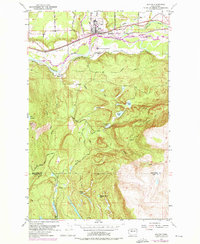
1953 Map of Sultan
USGS Topo · Published 1976About this map
The confluence of the Sultan River and the Skykomish River anchors this landscape at the town of Sultan. During the mid-20th century, the Burlington Northern railroad carved a primary corridor through the valley, supporting a local economy tied to the surrounding timberlands and waterways. To the north of the town, a Landing Strip and the Sultan Basin Road indicate the early development of aviation and transport infrastructure in this corner of Snohomish County.
Find a feature on this map
40 named features on this map. Tap any name to fly to it.
Don’t see what you’re looking for? This feature index may not catch every label — zoom into the map to look around manually.
Map Details
Editions of this 1953 Sultan Map
4 editions found
Other maps of this area

1921 · Sultan
USGS Topo · 1:125,000

1923 · Sultan
USGS Topo · 1:125,000

1953 · Sultan
USGS Topo · 1:24,000

1953 · Lake Joy
USGS Topo · 1:24,000

1953 · Monroe
USGS Topo · 1:24,000

1953 · Carnation
USGS Topo · 1:24,000

1956 · Monroe
USGS Topo · 1:62,500

1957 · Index
USGS Topo · 1:62,500

1957 · Wenatchee
USGS Topo · 1:250,000

1960 · Mount Si
USGS Topo · 1:62,500