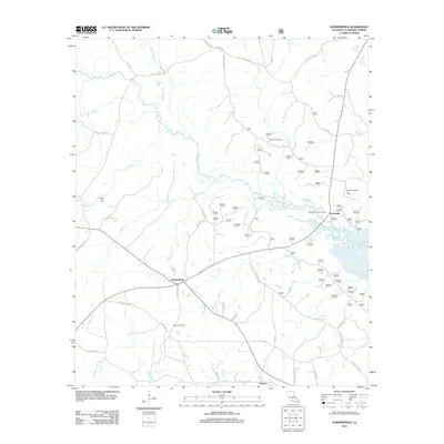
2012 Map of Summerfield
USGS Topo · Published 2012About this map
Summerfield and the neighboring settlements of Scottsville and Hebron anchor this portion of Claiborne Parish, reflecting a landscape defined by North Louisiana's energy and timber history. The map highlights the industrial importance of the region with the Lisbon Gas Field and Southwest Lillie Oil Field, while the Rocky Hill Lookout Tower stands as a sentinel for the surrounding pine forests. Waterways like Little Cornie Bayou and Sugar Cr (Sugar Creek) drain the terrain, with Sugar Creek Camp and Corney Lake providing recreational points of interest. Genealogists may find value in the location of the Spring Hill Cem (Spring Hill Cemetery) situated near Alford Cr, while the network of named roads such as Cupps Crossing Rd and Fellowship Rd trace the movement between rural homesteads and agricultural centers.
Find a feature on this map
85 named features on this map. Tap any name to fly to it.
Don’t see what you’re looking for? This feature index may not catch every label — zoom into the map to look around manually.
Map Details
Editions of this 2012 Summerfield Map
This is the sole edition of this map. No revisions or reprints were ever made.
Other maps of this area

1927 · El Dorado
USGS Topo · 1:62,500

1930 · El Dorado
USGS Topo · 1:62,500

1951 · Summerfield
USGS Topo · 1:62,500

1951 · Bernice
USGS Topo · 1:62,500

1951 · El Dorado
USGS Topo · 1:62,500

1953 · El Dorado
USGS Topo · 1:250,000

1955 · Shreveport
USGS Topo · 1:250,000

1956 · Shreveport
USGS Topo · 1:250,000

1957 · El Dorado
USGS Topo · 1:250,000

1958 · El Dorado
USGS Topo · 1:250,000