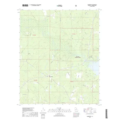
2018 Map of Summerfield
USGS Topo · Published 2018About this map
Summerfield and Scottsville anchor this portion of northern Claiborne Parish, situated in a landscape defined by the expansive Kisatchie National Forest. The terrain is deeply inscribed by a dense network of waterways, including Corney Bayou, Little Corney Creek, and Sugar Creek, which wind through the timbered tracts. This contemporary survey reveals a rural infrastructure where family and local history are preserved in names like Hickory Grove Cemetery and roads such as Bailey Town Rd and Thurmon School Rd.
Find a feature on this map
48 named features on this map. Tap any name to fly to it.
Don’t see what you’re looking for? This feature index may not catch every label — zoom into the map to look around manually.
Map Details
Editions of this 2018 Summerfield Map
This is the sole edition of this map. No revisions or reprints were ever made.
Other maps of this area

1927 · El Dorado
USGS Topo · 1:62,500

1930 · El Dorado
USGS Topo · 1:62,500

1951 · Summerfield
USGS Topo · 1:62,500

1951 · Bernice
USGS Topo · 1:62,500

1951 · El Dorado
USGS Topo · 1:62,500

1953 · El Dorado
USGS Topo · 1:250,000

1955 · Shreveport
USGS Topo · 1:250,000

1956 · Shreveport
USGS Topo · 1:250,000

1957 · El Dorado
USGS Topo · 1:250,000

1958 · El Dorado
USGS Topo · 1:250,000