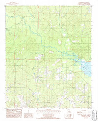
1986 Map of Summerfield
USGS Topo · Published 1986About this map
Summerfield serves as the primary hub of this north Louisiana landscape, characterized by a complex network of waterways that define the Claiborne Parish terrain in the 1980s. The convergence of Corney Bayou and Little Corney Bayou dominates the northern reaches, while the southeastern corner is shaped by the waters of Corney Lake. Much of the eastern portion of the map is dedicated to the Kisatchie National Forest, preserving the wooded character of the region alongside active resource extraction sites such as Gravel Pits located south of the main settlement.
Find a feature on this map
22 named features on this map. Tap any name to fly to it.
Don’t see what you’re looking for? This feature index may not catch every label — zoom into the map to look around manually.
Map Details
Editions of this 1986 Summerfield Map
This is the sole edition of this map. No revisions or reprints were ever made.
Other maps of this area

1927 · El Dorado
USGS Topo · 1:62,500

1930 · El Dorado
USGS Topo · 1:62,500

1951 · Summerfield
USGS Topo · 1:62,500

1951 · Bernice
USGS Topo · 1:62,500

1951 · El Dorado
USGS Topo · 1:62,500

1953 · El Dorado
USGS Topo · 1:250,000

1955 · Shreveport
USGS Topo · 1:250,000

1956 · Shreveport
USGS Topo · 1:250,000

1957 · El Dorado
USGS Topo · 1:250,000

1958 · El Dorado
USGS Topo · 1:250,000