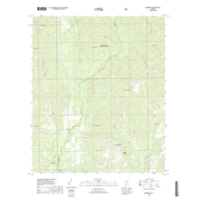
2018 Map of Summerfield
USGS Topo · Published 2018About this map
Summerfield and Valley Grande anchor this Dallas County landscape, where the northern reaches are dominated by the woodland of the Talladega National Forest. The area is defined by its complex drainage network, with Oakhulgee Creek and Little Oakhulgee Cr winding through the center, crossed by historic local landmarks such as Melton Bridge and Long Bridge. Small settlements like Stonewall, Augustin, and Perryville appear along the roads and river bottoms, providing a clear view of the rural habitation patterns in central Alabama. Genealogists will find the locations of Shiloh Cem and Martin Cem particularly useful for tracing family roots. The map also details topographical features like Honey Hill and Independent Bottom, showing how the terrain influenced the placement of AL Highway 219 and various county routes that connect these historically agricultural communities.
Find a feature on this map
71 named features on this map. Tap any name to fly to it.
Don’t see what you’re looking for? This feature index may not catch every label — zoom into the map to look around manually.
Map Details
Editions of this 2018 Summerfield Map
This is the sole edition of this map. No revisions or reprints were ever made.
Other maps of this area

1891 · Clanton
USGS Topo · 1:125,000

1953 · Montgomery
USGS Topo · 1:250,000

1956 · Montgomery
USGS Topo · 1:250,000

1957 · Montgomery
USGS Topo · 1:250,000

1957 · Benton
USGS Topo · 1:62,500

1958 · Selma
USGS Topo · 1:62,500

1958 · Selma
USGS Topo · 1:24,000

1959 · Plantersville
USGS Topo · 1:62,500

1959 · Summerfield
USGS Topo · 1:62,500

1975 · Selma NW
USGS Topo · 1:24,000