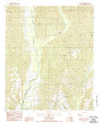
1987 Map of Summerfield
USGS Topo · Published 1987About this map
Talladega National Forest dominates the northern landscape of this region, where the terrain is defined by a dense network of drainages along the Perry Co Dallas Co border. Small settlements like Perryville and Stonewall appear as quiet rural junctions amidst the undulating topography. The area is heavily marked by its water systems, from the meandering Oakmulgee Creek to the southern reaches of Valley Creek. In the northeast corner, Paul M Grist State Park surrounds Pardue Lake, providing a distinct pocket of public recreation land. The road network follows the natural contours of the ridges between numerous branches and creeks, including Mitchell Creek and Little Oakmulgee Creek, illustrating a settlement pattern dictated by the area's intricate hydrology.
Find a feature on this map
20 named features on this map. Tap any name to fly to it.
Don’t see what you’re looking for? This feature index may not catch every label — zoom into the map to look around manually.
Map Details
Editions of this 1987 Summerfield Map
This is the sole edition of this map. No revisions or reprints were ever made.
Other maps of this area

1891 · Clanton
USGS Topo · 1:125,000

1953 · Montgomery
USGS Topo · 1:250,000

1956 · Montgomery
USGS Topo · 1:250,000

1957 · Montgomery
USGS Topo · 1:250,000

1957 · Benton
USGS Topo · 1:62,500

1958 · Selma
USGS Topo · 1:62,500

1958 · Selma
USGS Topo · 1:24,000

1959 · Plantersville
USGS Topo · 1:62,500

1959 · Summerfield
USGS Topo · 1:62,500

1975 · Selma NW
USGS Topo · 1:24,000