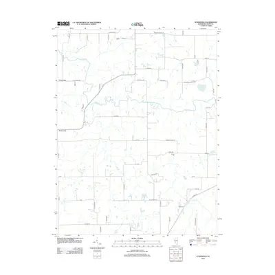
2012 Map of Summerville
USGS Topo · Published 2012About this map
Macoupin Cr winds across this central Illinois landscape, defining the topography of western Macoupin County. The map details the rural character of the region during the early twenty-first century, centered on the small settlements of Summerville and Challacombe. This agricultural area is networked by numerous named local routes such as Victory Rd and Coop Rd, illustrating a longstanding pattern of land divisions and farm access. For those researching local history, the map identifies specific points of interest including Gelder Cem and Armour Cem, alongside distinctive water features like Mowens Lake and Bullard Lake. The presence of roads like Harmony Church Rd and Macgomery Church Cp Rd hints at the locations of community institutions that have anchored this farming district for generations.
Find a feature on this map
55 named features on this map. Tap any name to fly to it.
Don’t see what you’re looking for? This feature index may not catch every label — zoom into the map to look around manually.
Map Details
Editions of this 2012 Summerville Map
This is the sole edition of this map. No revisions or reprints were ever made.
Other maps of this area

1912 · Gillespie
USGS Topo · 1:62,500

1915 · Gillespie
USGS Topo · 1:62,500

1923 · Carlinville
USGS Topo · 1:48,000

1925 · Carlinville
USGS Topo · 1:62,500

1925 · Brighton
USGS Topo · 1:62,500

1928 · Brighton
USGS Topo · 1:62,500

1931 · Carlinville
USGS Topo · 1:62,500

1932 · Greenfield
USGS Topo · 1:62,500

1948 · Quincy
USGS Topo · 1:250,000

1956 · Quincy
USGS Topo · 1:250,000