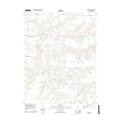
2015 Map of Summerville
USGS Topo · Published 2015About this map
Macoupin Creek meanders through this portion of Macoupin County, carving a textured drainage pattern into the central Illinois prairie. The settlement of Shipman anchors the southern edge of the sheet, while the smaller hamlets of Summerville and Challacombe sit along the western corridors. The landscape is primarily defined by its agricultural grid, intersected by family-named routes like Kallal Ln and Sarginson Ln. Local history is preserved in small rural burial grounds such as Gelder Cem in the north and Armour Cem further south. Water resources beyond the main creek include Bullard Lake and Mowens Lake, which serve as landmarks in an area otherwise dominated by the seasonal flow of tributaries like Coop Br. This survey documents the transition between the rolling timberland of the creek bottoms and the level upland farms that characterize the region's geography.
Find a feature on this map
52 named features on this map. Tap any name to fly to it.
Don’t see what you’re looking for? This feature index may not catch every label — zoom into the map to look around manually.
Map Details
Editions of this 2015 Summerville Map
This is the sole edition of this map. No revisions or reprints were ever made.
Other maps of this area

1912 · Gillespie
USGS Topo · 1:62,500

1915 · Gillespie
USGS Topo · 1:62,500

1923 · Carlinville
USGS Topo · 1:48,000

1925 · Carlinville
USGS Topo · 1:62,500

1925 · Brighton
USGS Topo · 1:62,500

1928 · Brighton
USGS Topo · 1:62,500

1931 · Carlinville
USGS Topo · 1:62,500

1932 · Greenfield
USGS Topo · 1:62,500

1948 · Quincy
USGS Topo · 1:250,000

1956 · Quincy
USGS Topo · 1:250,000