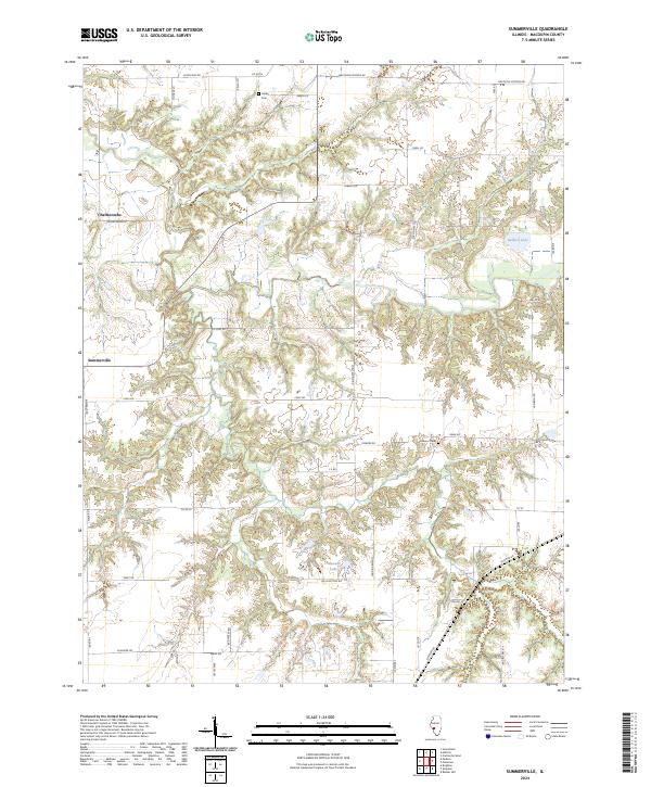
2024 Map of Summerville
USGS Topo · Published 2024About this map
The crossroads of Summerville and the small cluster at Challacombe anchor this modern survey of central Illinois. The landscape is defined by the sharp transition between flat agricultural uplands and the deeply carved drainages that flow toward the Macoupin Creek watershed. Small water bodies like Bullard Lake and Mowens Lake dot the terrain, while the road network reflects the area's rural heritage, including names like Macoupin Church Camp Rd and Macoupin Station Rd. Local history is preserved in small family and community burial grounds, specifically Gelder Cem in the north and Armour Cem further south. The map provides a clear picture of how historical settlement patterns, often following ridge lines like Ridge Rd, continue to shape the contemporary Macoupin County countryside.
Find a feature on this map
43 named features on this map. Tap any name to fly to it.
Don’t see what you’re looking for? This feature index may not catch every label — zoom into the map to look around manually.
Map Details
Editions of this 2024 Summerville Map
This is the sole edition of this map. No revisions or reprints were ever made.
Other maps of this area

1912 · Gillespie
USGS Topo · 1:62,500

1915 · Gillespie
USGS Topo · 1:62,500

1923 · Carlinville
USGS Topo · 1:48,000

1925 · Carlinville
USGS Topo · 1:62,500

1925 · Brighton
USGS Topo · 1:62,500

1928 · Brighton
USGS Topo · 1:62,500

1931 · Carlinville
USGS Topo · 1:62,500

1932 · Greenfield
USGS Topo · 1:62,500

1948 · Quincy
USGS Topo · 1:250,000

1956 · Quincy
USGS Topo · 1:250,000