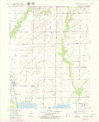
1949 Map of Sumner
USGS Topo · Published 1979About this map
Sumner serves as the primary hub in this Missouri landscape where the Chicago Burlington and Quincy railroad crosses the wetlands and prairies of Linn and Chariton Counties. The map details a region defined by complex hydrology, featuring the wide basins of Swan Lake and Silver Lake within the Swan Lake National Wildlife Refuge. To the north, Pershing State Park preserves the bottomlands along Locust Creek, a terrain dotted with numerous smaller water bodies like Boiler Lake and Harlow Fay Lakes. Genealogists and local historians can find significant landmarks from the mid-20th century, including the Forker Boomer PO, rural school sites such as Prairie Mound Sch, and resting places like Lakeside Cemetery and Purvis Cem. The extensive levee systems throughout the Cunningham and Jefferson townships illustrate the historic efforts to manage the flow of Turkey Creek and its tributaries.
Find a feature on this map
27 named features on this map. Tap any name to fly to it.
Don’t see what you’re looking for? This feature index may not catch every label — zoom into the map to look around manually.
Map Details
Editions of this 1949 Sumner Map
2 editions found
Other maps of this area

1924 · Chula
USGS Topo · 1:62,500

1924 · Hale
USGS Topo · 1:62,500

1946 · Brookfield
USGS Topo · 1:62,500

1947 · Chula
USGS Topo · 1:62,500

1948 · Brookfield
USGS Topo · 1:62,500

1949 · Mendon
USGS Topo · 1:24,000

1949 · Indian Grove
USGS Topo · 1:24,000

1949 · Sumner
USGS Topo · 1:24,000

1949 · Rothville
USGS Topo · 1:24,000

1950 · Sumner
USGS Topo · 1:24,000