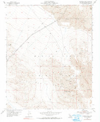
1955 Map of Sunshine Peak
USGS Topo · Published 1990About this map
Lava Bed Mountains and the volcanic landscape of the Mojave Desert dominate this mid-century survey, defined by extensive volcanic fields and the prominent Pisgah Crater in the northeast. The map records a significant industrial and military presence during the Cold War era, including the expansive Marine Corps Training Center and a marked Naval Reservation Boundary.
Find a feature on this map
18 named features on this map. Tap any name to fly to it.
Don’t see what you’re looking for? This feature index may not catch every label — zoom into the map to look around manually.
Map Details
Editions of this 1955 Sunshine Peak Map
5 editions found
Other maps of this area

1953 · San Bernardino
USGS Topo · 1:250,000

1954 · Galway Lake
USGS Topo · 1:24,000

1955 · Lavic SE
USGS Topo · 1:24,000

1955 · Silver Bell Mine
USGS Topo · 1:24,000

1955 · Sunshine Peak
USGS Topo · 1:24,000

1955 · Lavic Lake
USGS Topo · 1:24,000

1955 · Newberry
USGS Topo · 1:62,500

1955 · Lavic
USGS Topo · 1:62,500

1955 · Cady Mountains
USGS Topo · 1:62,500

1955 · Rodman Mountains
USGS Topo · 1:62,500