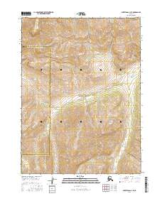
2016 Map of Survey Pass C-4 SE
USGS Topo · Published 2016About this map
Gates of the Arctic National Park encompasses the majority of this interior Alaskan landscape, characterized by the dramatic elevation changes and watershed systems of the Brooks Range. The topographical data reveals the winding path of Goshelpme Cr, which flows southward through the eastern portion of the quadrangle. This 2016 survey documents the precise boundary between the Northwest Arctic Borough and the Yukon-Koyukuk Census Area, a line that cuts horizontally across the northern tier of the sheet. The map is primarily an environmental record of high-altitude terrain, defined by the Public Land Survey System grids including t25n r19e and t26n r19e, which provide a framework for navigating this remote wilderness where human-named features are exceptionally rare.
Find a feature on this map
9 named features on this map. Tap any name to fly to it.
Don’t see what you’re looking for? This feature index may not catch every label — zoom into the map to look around manually.
Map Details
Editions of this 2016 Survey Pass C-4 SE Map
This is the sole edition of this map. No revisions or reprints were ever made.
Other maps of this area

1951 · Survey Pass
USGS Topo · 1:250,000

1956 · Survey Pass
USGS Topo · 1:250,000

1964 · Survey Pass
USGS Topo · 1:250,000

1966 · Survey Pass
USGS Topo · 1:250,000
1986 · Survey Pass C-3
USGS Topo · 1:63,360
1986 · Survey Pass C-4
USGS Topo · 1:63,360
1990 · Survey Pass B-4
USGS Topo · 1:63,360
1990 · Survey Pass B-3
USGS Topo · 1:63,360
2016 · Survey Pass C-4 NE
USGS Topo · 1:25,000
2016 · Survey Pass C-4 SW
USGS Topo · 1:25,000